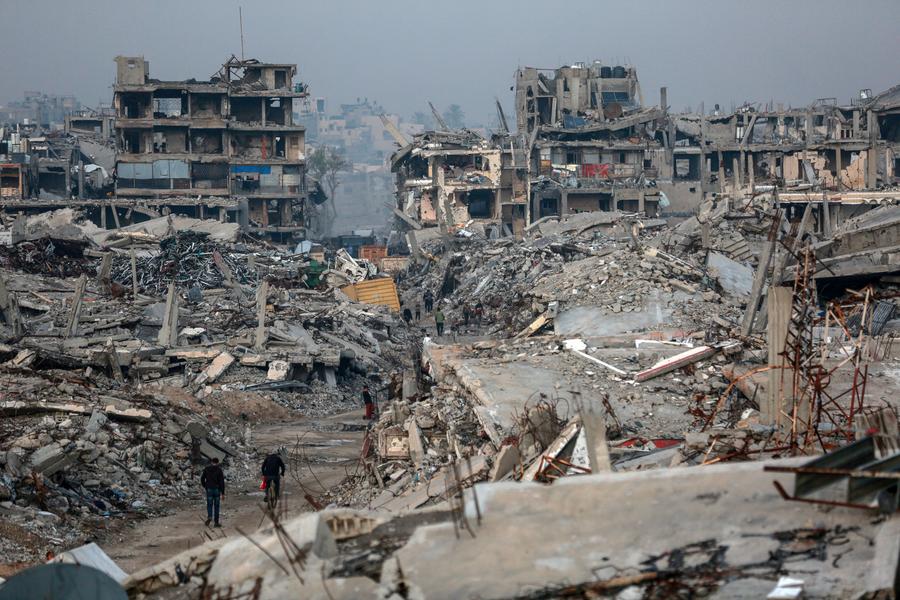

THERE is not much of a beach left at Tok Jembal. What was once an expanse of soft fine sand, the kind of idyllic shore which Terengganu is famed for, is now just a sliver that ends abruptly in a tumble of rocks.
The beach, some 20km from Kuala Terengganu town, is being gnawed away by the sea. The wall of boulders, though unsightly – it robs tourists of the picture-perfect image of a palm-lined beach – is necessary to hold back the engulfing water.
“This area is eroding at a rate of 11m annually,” says Department of Irrigation and Drainage (DID) engineer Salmiah Abdul Rahman. “If left as is, this beach will disappear.”
 She says 4.2km of coastline at Tok Jembal (between the Sultan Mahmud Airport and Mengabang Gelam) is affected. Erosion there is classified under Category 1, the most serious level, as at stake are village houses, local shops and a cemetery. Already, the sea has engulfed 80m of the beach. At its worst in 2011, the erosion caused the collapse of the coastal road as well as holiday chalets and a building belonging to Universiti Malaysia Terengganu.
Work to save the Tok Jembal shoreline started in 2011, with rock revetment constructed on 1.9km of the worst-affected beach. More remedial work commenced in April this year. The protective rock wall is now 3.8km-long. To buffer strong waves, four breakwaters will be built 150m from shore, parallel to the beach. A 100m-long groyne will be built at one end of the beach, to help in accretion of beach sand.
Terengganu DID assistant director Muhamad Kadir says once these structures are completed, the lost sand will be replenished to return the beach to its original state. The RM70mil project is targeted for completion in 2016.
Muhamad says erosion in the state is worsening. Affected coastlines are in Besut, Dungun and Chendering. Previous DID studies showed that 62% of the state’s 244km of coastline is wearing away. While the state is prone to erosion because of strong waves during the monsoon, coastal development projects and various man-made structures can aggravate things.
When one section of the coastline is altered, the hydrological regime changes, causing sand to be eaten away or deposited elsewhere along the coast. The change then becomes a continuous cycle. It was reported that after wave breakers were constructed in Chendering to control erosion, the problem moved to the nearby area of Rhu Rendang.
Salmiah says erosion at Tok Jembal worsened following land reclamation for the airport expansion in 2010. The coastline near the airport, on the other hand, started eroding after the project to deepen the Sungai Terengganu river mouth.
In that scheme, two breakwaters, 2.3km and 1.1km long, were built on either side of the river mouth to reduce sediment build-up, which had obstructed boat navigation.
“The sedimentation had also posed a hazard to boats as they get stuck in sand bars. During the monsoon when there are strong waves, the boats can capsize,” says DID assistant engineer Ismail Jusoh.
With the completion of the project in 2008, boats can now come and go without being obstructed by shallow waters. Some 30ha of land has also been reclaimed behind the breakwater. – thestaronline